
Morning!
This is my first total detailed blog post and well, luckily it’s about the Peb trek! The first actual trek of my life was indeed Peb, in the year 2009. I have been there for total 3 times.

(P.s. the proper trek guide’s type photographs might come after monsoon season)
Trek info : Peb, also known as Vikatgad , is a small trek in sahyadri near Matheran in Raigad district, Maharashtra. It’s at the height of approx 2100 ft above sea level. Difficulty level : medium.
The major twist in the story is that Peb is known for it’s confusing routes. Sometimes, you end up taking God knows which route to climb and while descending, you again end up in God knows which village. Almost everyone whom I have talked to (and who have gone there) have lost their way at least once, and I am not an exception too!
So, with the monsoon starting up, we few planned for Peb trek on Sunday, 25 June 2017. The first trek of the monsoon had too many hurdles! (Nothing should be too easy, right?)
First, we were welcomed by heavy rains since last night, which of course, resulted in delayed trains. We took the train at 7:20 a.m. from Dombivali (which was supposed to be at 6:30 a.m.), reached Neral after an hour, had our breakfast and left Neral station by 9:10a.m., furiously as Matheran tourists (pun intended) started their nuisance. We were an hour late to start our trek.
I am mentioning the route that one of the locals told us. With Neral area developing fast and too many people visiting this trek, This might not be the actual route and if you are going for this trek for the first time or unsure about the route, take a Guide!
So from Neral station, we were supposed to take the road parallel to track towards Mumbai, cross a stream, cross Karjat road, reach dilkap college and reach Ganesh Mandir. (I ended up there by mistake while coming back). While ascending, we lost our way before Dilkap college and after walking for 10 min, directly started climbing the fort without ending up in any village. (Kind of shortcut!). You can always ask locals for the way and they are okayishly helpful too!
Nevertheless, we started climbing and following the huge electricity towers. There are total 3 towers on the way. A 10 min walk after 3rd tower, we came across another clearing.

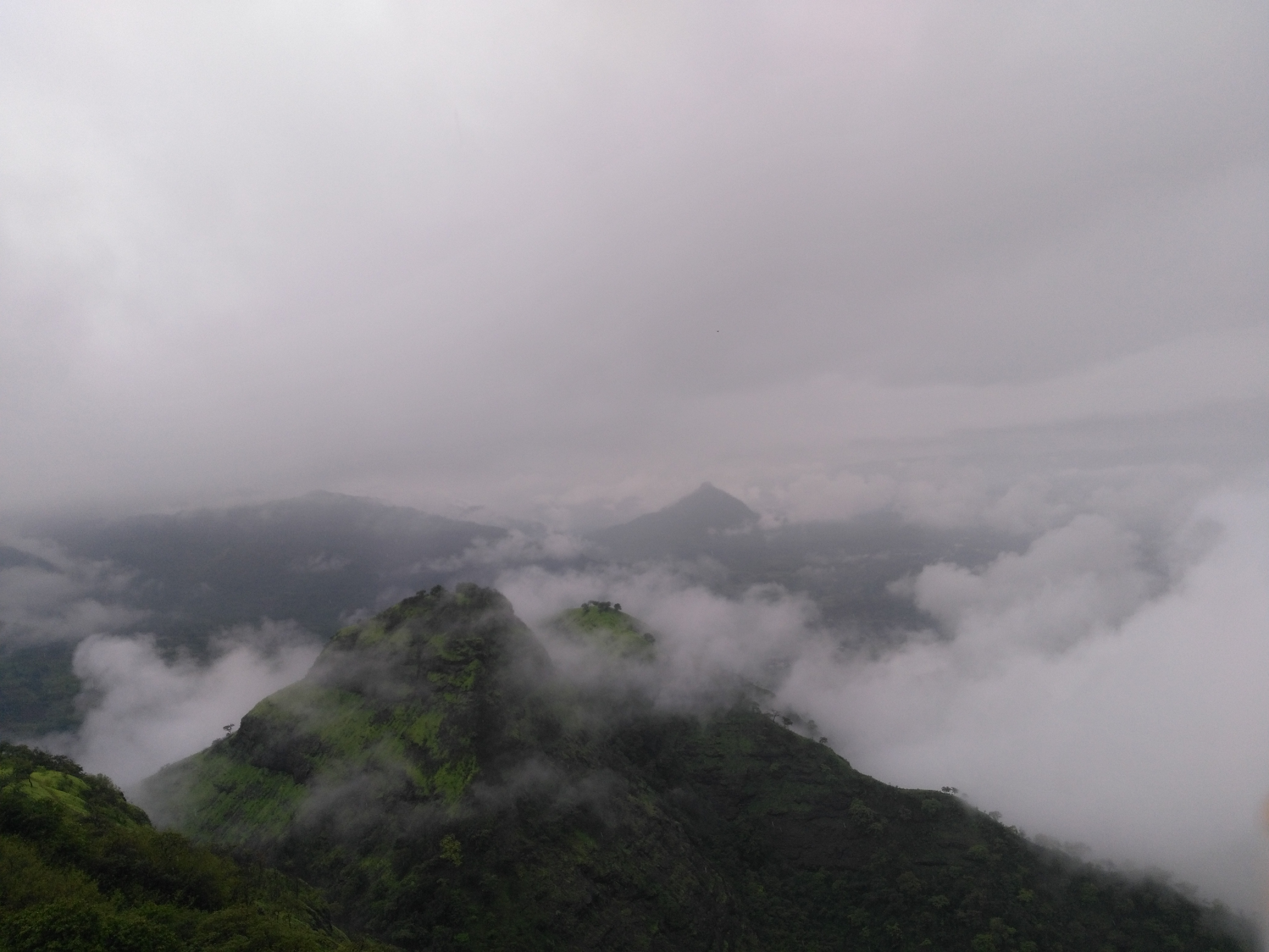
The main trick of the trek route is to reach in that ‘V’ shaped gap as in the photo (towards left of the V shape gap, we have the main mountain, covered in fog).
After we reached the spot mentioned above(the opening/clearing after tower), we kind of took a wrong turn, went through dense forest and ended up taking a scary route through the stream. With the heavy rains, the stream route turned out to be an adventure( also,another shortcut),but we did find the actual route shortly.
As I have been to this trek few times, in my opinion, main trick to follow is fort base, 3 towers and reaching that V shaped gap WITHOUT taking a challenging route. From that gap, the route to the top goes behind the mountain and we have the 15 ft rock patch, cave ,ladder on the same route.
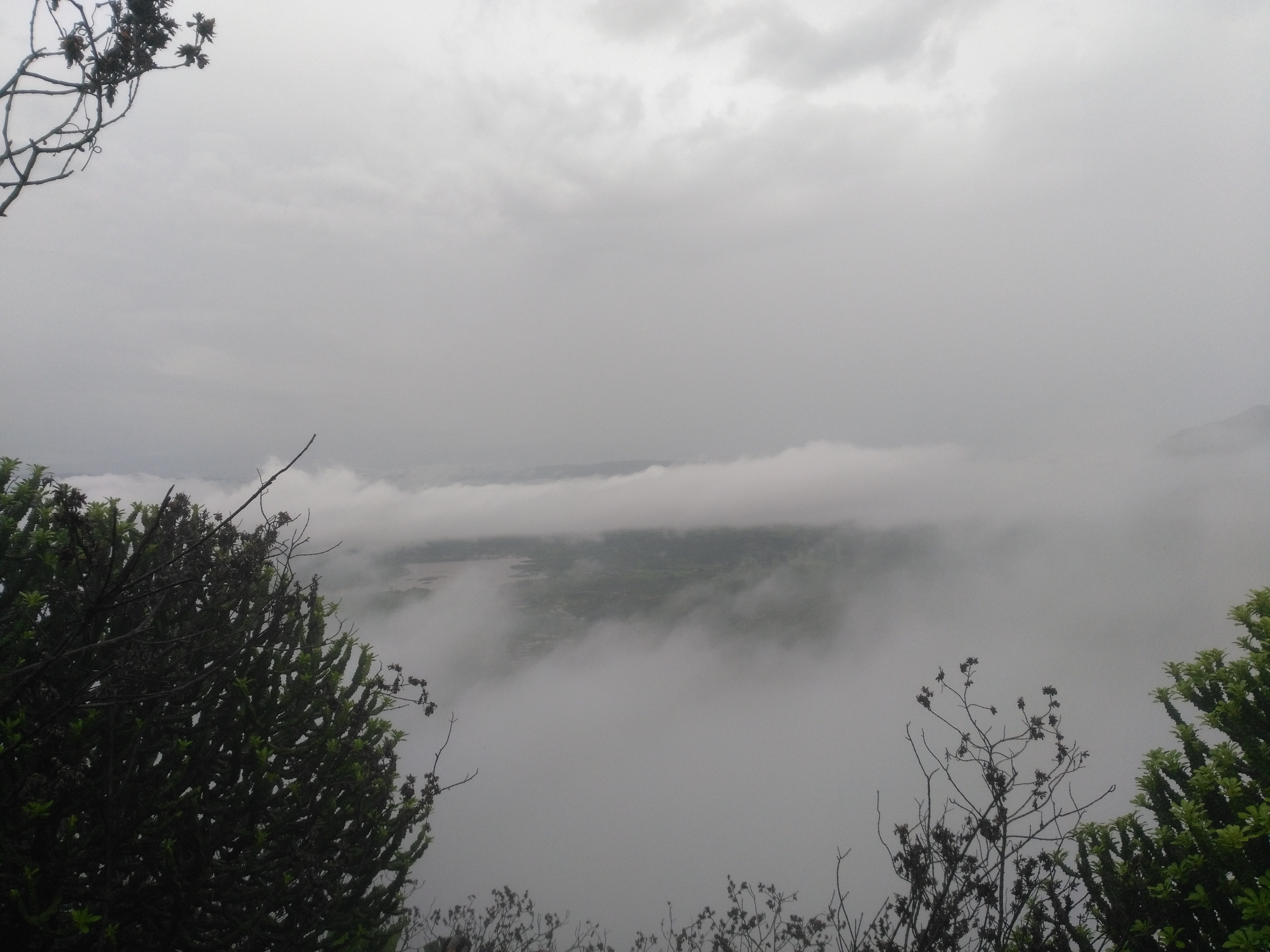
The view after reaching that gap was amazing!

Continuing the route , after reaching the V shape gap, we reach a small 15 ft rock patch. It is actually not that difficult as it looks. Sadly, when we went for the trek, it was a Sunday in the monsoon and it was crowded. We had to wait for an hour just to climb the patch.

5 min walking after climbing the patch and we come across a diversion. We took the route going slightly downwards as it’s easier. After that, another 5 min walking and we reach the cave. It is actually a kind of small temple.Time for lunch!

Following the same route, after the cave, we reach the ladder. (Now there are two ladders to climb the same spot…choose any!). It was too cloudy when we reached there to take any photos. Ladders are easy to cross. After that, the route is kind of common sense and in 15 min. , we reach the top. The last 5 min of the climb, in rains, is quite slippery, but nothing to worry about.There is a small temple of Swami Samarth at the top.
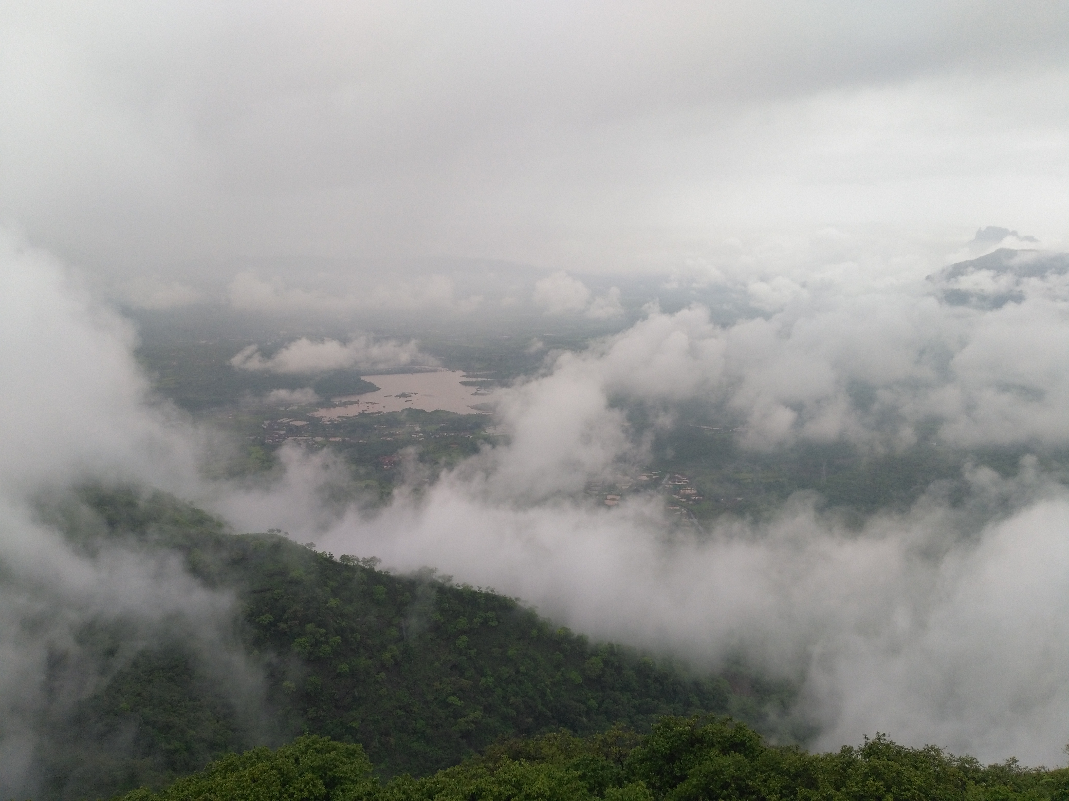
I had some of the best views of my life this time from the top. No comments on that please!


(You can spot the electricity towers as well)
With good visibility conditions, you should be able to see fort Chanderi, Malang gad, Prabalgad, Irshalgad, Matheran range and all the way up to Peth (kothaligad), Bhimashankar range etc from the Peb top. 3.5 hours climb should be enough from the base to the top.
As I said earlier, one of my friend and I kind of took a ‘shortcut’ and reached Ganesh Mandir at the base while coming down. Following the well made tar road from there, it took us half an hour walk to reach neral station.
Peb is a good gateway without having to deal with the crowd. Although, in monsoon weekends, the place is crowded, but nothing compared to Matheran. (Seriously!) Gives scenic views and a thrilling trek experience with the confusing routes and climbing patches!
A proper guide post will be on it’s way after rains!
Till then, have fun!

Why did they put up another ladder at the fort wall? The first one was good enough!
LikeLike
Maybe because now Peb has too much of crowd. It’s an awkward scenario if we have to wait for another hour to cross the ladder.(We already spent an hour to cross the rock patch.)
The second ladeer is even easier to cross.
LikeLike
That but kills all the little thrill it had! I would have have thought they would look into the crumbling wall overlooking the double ladder on the Matheran side before putting another one near the cave!
LikeLike
Sounds more like traffic management (or maybe with recent accidents at Peb. ) the first ladder has stream coming on it. Second one doesn’t.
LikeLike